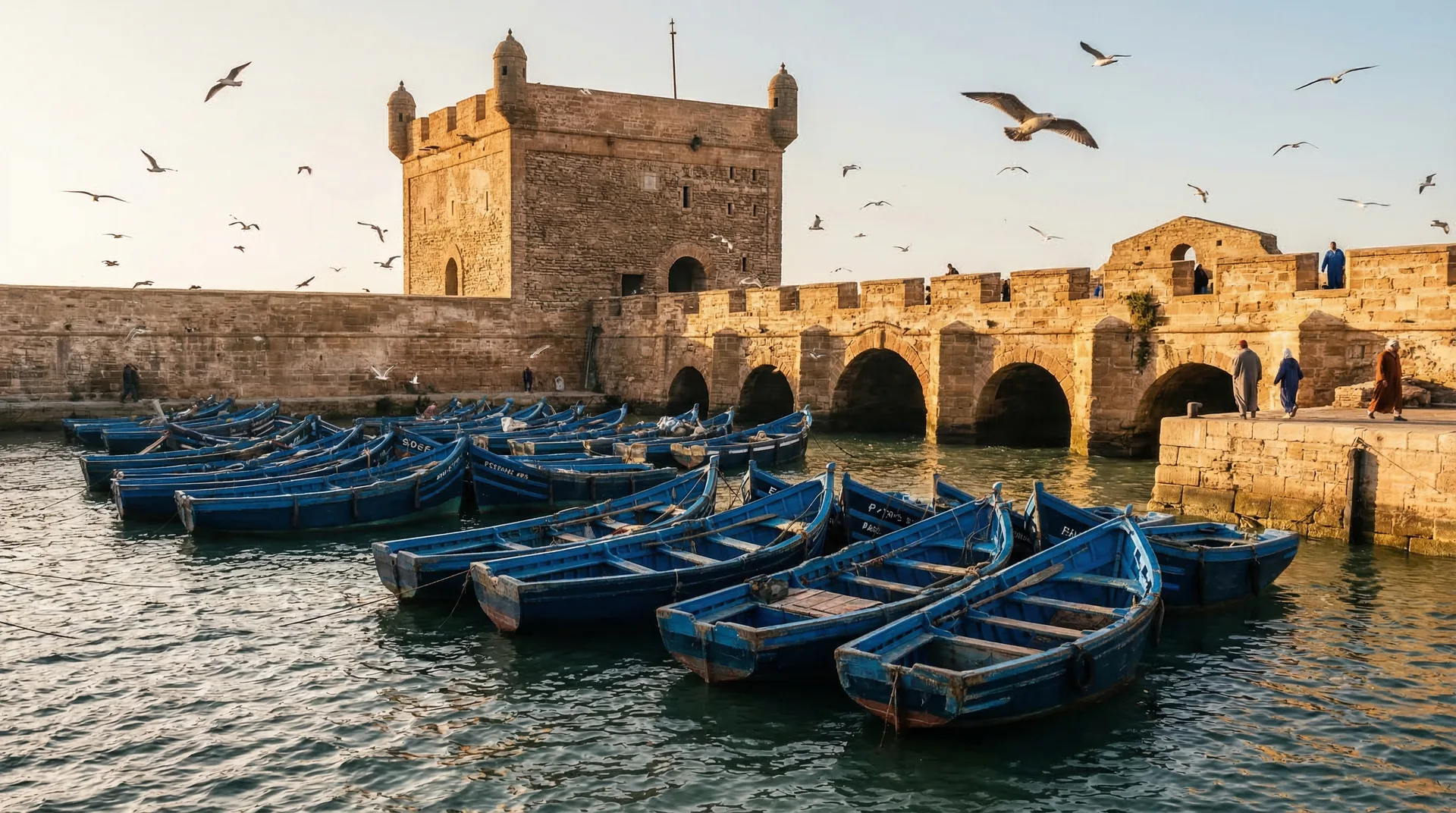
Most of Morocco's medinas grew up slowly over centuries — Essaouira did not. The walled town you walk today was a planned port, laid out in the 1760s on the orders of the Alaouite sultan Sidi Mohammed ben Abdallah, who wanted a fortified harbour to channel the kingdom's Atlantic and trans-Saharan trade through a single royal gateway. The result is a rare thing: a deliberately designed 18th-century fortified town, with straight streets, sea-facing bastions and a cosmopolitan merchant population, that UNESCO inscribed as a World Heritage Site in 2001. This guide traces how Mogador came to be — its older roots, the sultan's grand plan, the European-influenced fortifications, the merchant trade that made it rich, and where you can still read that history in the streets and ramparts.
The bay was known and used long before the 18th-century town. Its sheltered anchorage behind the island had drawn sailors and traders since antiquity, and Mogador appears on European charts as a port of call. A Portuguese presence in the early 1500s left a coastal fort, the Castelo Real, and the name 'Mogador' itself is generally traced back to this earlier era rather than to the sultan's new town.
02Founding
Sidi Mohammed ben Abdallah's grand plan
Around the 1760s the Alaouite sultan Sidi Mohammed ben Abdallah set out to build a new royal port from scratch. The aim was strategic and commercial: to create a fortified harbour that could concentrate Morocco's overseas trade — and its customs revenue — under the crown's direct control, drawing it south away from less governable ports. The town was renamed Essaouira, often understood as 'the little rampart' or 'the well-designed', reflecting its planned character.
03Urbanism
A town designed on a grid
Unlike Morocco's organically grown medinas, Essaouira was laid out with notably regular, broad and straight main streets and a clear plan — a layout that still makes it one of the easiest old towns in the country to navigate. This deliberate European-influenced urbanism, combined with the fortifications, is a key reason UNESCO recognises it as an exceptional example of a late-18th-century fortified town.
04Architecture
The fortifications and Théodore Cornut
The town's distinctive star-shaped bastions and sea walls reflect European military engineering of the period. The design is widely associated with Théodore Cornut, a French engineer said to have worked on the plans, alongside other builders and influences. Whatever the exact authorship, the result married North African medina life with Vauban-style coastal defences — a hybrid you can still walk along the ramparts.
05Ramparts
The Skala bastions and the brass cannons
The Skala de la Ville, the long sea-facing artillery platform, and the Skala du Port at the harbour are the most visible survivals of the defensive plan. The rows of old European-made brass cannons still lining the walls were part of arming the new port, and the wide ramparts remain the classic place to grasp how the town was built to face — and trade across — the Atlantic.
06Trade
The merchants who made Mogador rich
To fill his new port the sultan invited merchants — Moroccan Muslim and Jewish traders as well as European consuls and agents — and granted licences to the 'tujjar al-sultan', the sultan's own traders. Through Mogador flowed sugar, tea, spices, ostrich feathers, gum arabic and goods carried up from the south, making it for a long period Morocco's busiest commercial harbour and one of its most cosmopolitan towns.
07Heritage
A cosmopolitan port and its consulates
At its commercial height the town hosted foreign consulates and a mixed population of Muslims, a very large Jewish community and resident Europeans, trading with ports across the Atlantic and the Mediterranean. The grand merchant houses and former consular buildings near Place Moulay Hassan and the harbour are reminders of an outward-looking port that was, for its time, unusually plural.
08History
Decline, quiet years and rediscovery
As other ports such as Casablanca and Agadir grew in the late 19th and 20th centuries, Mogador's trade faded and the town slipped into quieter decades. That very quiet helped preserve its 18th-century fabric largely intact. From the 1960s onward it drew artists, musicians and travellers, and later windsurfers and festival-goers, setting up the revival the town enjoys today.
09Recognition
UNESCO World Heritage status
In 2001 UNESCO inscribed the Medina of Essaouira (formerly Mogador) on the World Heritage List, citing it as an outstanding and well-preserved example of a late-18th-century fortified town built to European designs in a North African setting. The listing recognises both the planned urbanism and the role the port played in trade between Europe, Morocco and sub-Saharan Africa.
10Itinerary
Reading the history on the ground
You can trace the whole story on foot in a half-day: start at the harbour and the Skala du Port, walk the Skala de la Ville ramparts and cannons, cut through the gridded streets and gates such as Bab Doukkala and Bab Marrakech, and pause at Place Moulay Hassan among the old merchant houses. A local guide can layer on the founding history, though the planned medina is easy to explore on your own.
Frequently asked
When was Essaouira (Mogador) founded?
The planned, fortified town was built in the 1760s on the orders of the Alaouite sultan Sidi Mohammed ben Abdallah, who wanted a royal port to control Morocco's Atlantic and trans-Saharan trade. The bay had been used as an anchorage long before that — including an earlier Portuguese presence in the 1500s — but the walled town you see today dates from the sultan's 18th-century project.
Why is the medina called Mogador?
'Mogador' is the older European name for the port, generally traced back to before the 18th-century town and used on charts and by foreign traders for centuries. When the sultan built his planned town it was named Essaouira — often understood as 'the little rampart' or 'the well-designed' — but the name Mogador stuck in many languages and is still widely recognised today.
Why does Essaouira have such straight, regular streets?
Because it was a planned town rather than one that grew organically. It was laid out in the 1760s with broad, straight main streets and star-shaped bastions, reflecting European military and urban design of the period — work often associated with the engineer Théodore Cornut. This deliberate plan is part of why the medina is a UNESCO World Heritage Site and why it is so easy to navigate.
What is the best way to see Essaouira's history?
On foot. A half-day walk links the harbour and the Skala du Port, the Skala de la Ville ramparts with their old brass cannons, the gridded streets and gates, and Place Moulay Hassan with its merchant houses. Going with a local guide adds the founding history and trade story, but the compact, well-preserved medina is also easy to explore independently.
See it with a local
Turn this into a private Essaouira trip.
We'll build a private, guided plan around the experiences you care about — with a driver, hand-picked riads and a written quote in 24 hours.